I have been asked to explain how the campaign and wargame maps are designed. I wanted to have a reasonably accurate map of Europe to plan wargame campaigns. But I also wanted to be able to transfer the map details to the wargames table without having to create a new map each time.
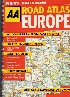
 I needed a good road map which covered all of Europe. This one was cheap and had the added advantage that it has two scales, 32 miles to 1 inch and 64 miles to 1 inch. First I photocopied all of the 1inch to 32 mile pages which covered central Europe.
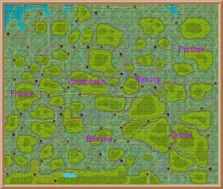
Using ProFantasy I created this map of central Europe. Each square is one page from the AA road map, approximately 250 miles square. This map is not to scale; it is what I call the Grand Strategy map. It shows major cities and their approximate distance from each other. I then drew a road between each, and these became my main supply routes.
Next I photocopied all of the 1 inch to 32 mile pages to create a large map of central Europe. I drew a grid on this map and each square was 20 miles. Each square would be one days march and one wargames table.
 Strategic Map - All Germany
I then created a grid map of Germany, on which each square was 20 miles. I added the rivers, major mountain ranges and main borders. I plotted the cities and added the red roads. I then added major towns, and connected them with a yellow road; this would be minor supply routes.
 Strategic Map North Germany - all towns
Finally I added a minor town to each empty square, and connected them with brown roads. These would represent tracks, and would not count for supply. To make it easier to read all of this detail I then created three maps of Germany - north, central and south.
 Campaign tactical map
For my campaign I need a map which covered a smaller area, which I could send to the players. This was copied from the main map of Germany. I call this map my tactical map. This one is used for our current PBEM campaign which has Hanover as the objective.
 Campaign wargames map
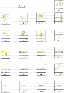
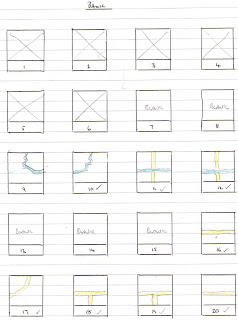
I call this map the wargames map. Each square has two reference numbers. One is the map square within the wargames map. This is shown on the top left of the square. The second is the number of the scenery square I will use to make up the wargames table. This is shown top right.

I have 20 2’x2’ scenery squares which I use to make up my wargames table. This page shows one side of each square. Each is numbered 1 to 20

This shows the reverse of those squares which do not have hills on them. Again numbered 1 to 20.
When two armies meet in the campaign, I draw a grid on the wargames map to indicate which squares will be used to make up the wargames table. This is the grid for the second battle of Colbitz, and shows the location of each corps at the start of the battle.
This is the wargames table set up for the second battle of Colbitz. I could only get part of the top three squares in the photograph. Colbitz itself is top right.
I have sued this system in my solo campaign for about two years, and it works well. I am play testing it for a PBEM campaign at present, and it seems to work well so far.


Hi Paul,
ReplyDeleteVery interesting to read how you put the maps together. Will certainly give my map making software another look. Found it took up too much of my time and shoved it to the side.
Cheers
Gerry
Hi Gerry
ReplyDeleteI thought for a long time before I bought ProFantasy. Not because of the cost, but because I thought it would be too difficult to learn.
I am certainly no expert, but I found it realatively easy to master. I guess it took about a week of working on their tutorials before I started on my own maps.
I found that it helped a lot to have a map to copy, and a clear idea of what I wanted to achieve.
Do find your software and give it another go.
regards
Paul
Thanks Paul,
ReplyDeleteA very good explanation of how you set it all up. Special thanks for the explanation on the numbered terrain squares; the squares with different terrain in the same 'number' were driving me nuts. :)
Dave
Any chance you could post these maps up for use by others? Ive been trying to look for an alternative of having to make my own one as i have no time with work and family. I havent been able to find a good enough style of map.
ReplyDeleteI would like to be able to use the large scale map of europe you have and the next stage ones you have too.
Do you have these posted somewhere?
Hi FlashStarr
ReplyDeleteAll of the maps are held on my copy of ProFantasy
I can send you a jpeg copy, but not sure how much use that might be
There is a diary blog of the whole campaign, which includes maps.
If you look on the right of the main page of this blog, you will see a list of links
One of them is to 1813 campaign diary
If you click on that it will take you to the other blog
If there is a particular map you would like a copy of, let me have your email and I will send you a jpeg copy.
regards
Paul